“Ow,” I said as the barbed wire fence snagged my leg. But satisfying my curiosity was totally worth it.
Sometimes it’s hard to tell whether a cemetery is visitable. (That’s why I contribute photos and reviews to Google Maps and Find a Grave, so that people can know if they can visit their ancestors.) This was true of the Deardorff Cemetery, aka the Christilla Pioneer Cemetery, in Happy Valley, Oregon. There was conflicting information online as to whether it’s on private property or not, and it looked like it involved a hike, so we had put off trying to visit. Then the day came when I needed an outing, and I needed to know for sure.
“If I can’t find the cemetery,” I thought, “at least I can get in a hike.” (The Scouters Mountain Nature Park is right next door.)
I parked at the approximate location of the blue star on the map below, a small gravelled parking area. Just a few feet away, the paved road continued up into the park. To the right, a trailhead. To the left, a trailhead. The lefthand trailhead looked most promising so I started up the path, a moderate climb.

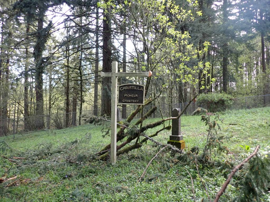
When I got to the approximate location of the blue dot on the above map, I found a trail post with a map that showed a stub of trail continuing ahead, as opposed to the main trail which doubled back on itself at some stone steps. Following the stub I came to a gate which I recognized from a Find a Grave photo. Assuming that there was an easement to what I presumed is a county cemetery, I scratched and scraped ahead. About a minute later I came to the Deardorff Cemetery, signed for the Christilla Pioneer Cemetery, surrounded by a chain link fence (approximate location of the dashed blue rectangle).
As it turns out the Find a Grave map is both the most and least accurate map. The orange pin is in the wrong location, but the map does show the original five acres set aside for the cemetery. (Only about one acre is used today.)
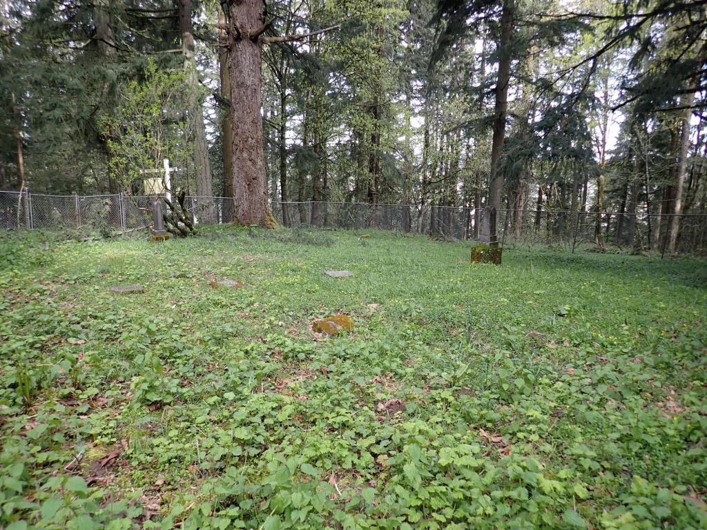
The cemetery today is a peaceful place in a grove of trees. Most of the surrounding area is covered in vinka, weeds, grass and other undergrowth. It deserves respect and care.
I also learned:
- Most of the individuals buried there were relatives of the Deardorffs
- Deardorff Road is named after the family
- The first burial occurred in 1852
- John M. Deardorff, an overland pioneer of 1950, established a donation land claim (DLC) including the cemetery site
- The cemetery is now cared for by the “Christilla Pioneer Cemetery Association” which proposes to help restore and maintain the cemetery.
- The deed has been obtained to set the graves aside as a county cemetery
- The cemetery has been denoted as “historic” and “worthy of preservation”
- The first person to be buried there is said to be an unknown man who had arrived in the same wagon train as the Deardorffs and who died in 1852, shortly after reaching the valley
- The last (most recent) grave is said to be of Edith Guidi, 1932, though there is at least one burial from 1988.
The difficulties I had in learning about the location of the cemetery are common to many pioneer cemeteries. Historical descriptions are vague, care and maintenance (if any) is done by volunteers, who may or may not still be organized, and semi-rural locations are surrounded by private property. I don’t know who can grant permission to visit inside the gates of the cemetery itself, but I’d start with Clackamas County.
Sources:
- http://www.happyvalleyor.gov/wp-content/uploads/2016/05/Final-East-Happy-Valley-Comprehensive-Plan-Text-Amendments.pdf
- https://www.findagrave.com/cemetery/38704/deardorff-cemetery
- http://gustaf.com/hvonweb/hvhist2.htm
Stump and Lamb explores personal growth and meaning via travels to pioneer cemeteries of the West.
This post was originally published at michellerau.com.
